There’s a new tool for anyone planning to hike the trails at Scanlon Creek Conservation Area.
The 282 hectare park just north of Bradford is criss-crossed by trails, from the 1.5 km Sugar Maple Loop, to the 3 km Kingfisher Trail that circles the lowlands, travelling through dense forest.
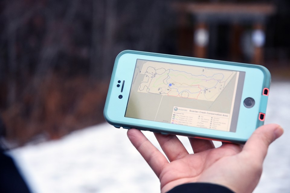
The free Avenza app not only provides an image of the trail system, it also shows the user’s location as a blue dot – providing the hiker’s place on the trail, distance to other trails, and rate of travel.
If you wander off the beaten path, the app clearly shows exactly where you are in relation to the nearest trails – and how to get back on track.
Once downloaded, the app doesn’t use the phone’s data – just the phone’s GPS system, to show location.
Not only does it make it impossible to get lost in the woods, “you have a sense of how long it’s going to take” to complete a hike, noted Sue Jagminas, Sr. Communications Advisor with the Lake Simcoe Region Conservation Authority (LSRCA). “I think it’s really beneficial for the person that’s nervous about going on the trails and getting lost.”
The maps were originally prepared by the LSRCA’s GIS team, noted Nancie Knight, which then partnered with Toronto software company Avenza Systems Inc. over a year ago.
“Scanlon was the first property we built,” said Knight, LSRCA Communications Specialist. Maps are also available for the Durham Regional Forest, Sheppard’s Bush, Rogers Reservoir, Thornton Bales Conservation area, and Bailey Ecological Park, and there are plans to continue to map the 140 km of trails managed by the LSRCA, in 24 conservation areas.
This week, James O’Dell brought sons Jack and Logan to Scanlon Creek C.A. for a brief hike in the woods – and was introduced to the Avenza App.
“It definitely helps,” O’Dell said. “It’s a great idea!”
The Avenza app is available free from the Apple App Store or Google Play. For more information, click here.
Once downloaded on a smart phone, users can click on the ‘Find Maps’ search bar, look for LSRCA, and then select the map wanted and click on “install.” Some maps do have a cost, but municipal and Conservation Authority maps are free.
“Search your municipality, and see what’s around you!” said Knight.
The app uses GPS to give hikers the assurance that they’ll never be lost in the woods - as long as they have their phone.


