Postcard Memories is a series of historic views, stories and photos of Bradford West Gwillimbury, a trip down memory lane on a Saturday morning.
While the Holland River has changed considerably over these many hundreds of years, it remains embedded in our historical psyche of the area to this day.
The Holland River was originally known as Micicaquean Creek, its Indigenous name. It was renamed by Lieut.-Gov. Simcoe after Capt. Samuel (Johannes) Holland, (1729–1801), the Dutch-born, first surveyor general of British North America.
The Holland River drains the local watershed into Cook's Bay on the southern extremity of Lake Simcoe. The river flows generally north from its headwaters in the Oak Ridges Moraine.
The Holland River watershed covers approximately 600 square kilometres (230 sq mi), spanning an area that includes New Tecumseth, King Township, Newmarket, Aurora, East Gwillimbury and Whitchurch-Stouffville. The river's watershed also contains the Holland Marsh, a fertile farmland region renowned for its vegetable production.
There are actual two branches of the river. The headwaters of the East Holland River rise in the Oak Ridges Moraine and run north from Newmarket through Holland Landing, where it joins up with the West Holland River.
The tributaries to the East Holland River include Sharon Creek, Bogart Creek, Tannery Creek (Aurora), Western Creek (west side of Newmarket), and Weslie Creek.
A man-made dam on the East Holland River in Newmarket maintains a man-made lake now called Fairy Lake, originally a millpond, but now used primarily for recreation. This dam has been there since about 1801.
If you read my past articles, you will recall that the dams have frequently been damaged, the latest by Hurricane Hazel in 1954.
Musselman Lake in Whitchurch-Stouffville feeds a creek that runs along the Vandorf Sideroad and into Weslie Creek. If you read my article on Mulock’s Canal, you will remember that even though there were concerns of a lack of water, construction of several locks was started along the river between Newmarket and Holland Landing as part of a Holland River Canal that would have joined Newmarket to the Trent-Severn Waterway via Lake Simcoe.
There is one lock in each of those places along with another at Rogers Reservoir in East Gwillimbury. Rogers Reservoir and Fairy Lake in Newmarket were to act as reservoirs for the canal waters. There were two swing bridges built in East Gwillimbury; one at Green Lane and the other on Main Street North (Concession 2). Both have been replaced by permanent structures.
On Green Lane, the road now runs slightly to the south and a pedestrian bridge crosses the old structure. There is also a quayside at Davis Drive in Newmarket. The canal works were abandoned early in the 20th century without ever being completed. The upper limit of navigation on the East Holland River remains at River Drive Park, about two kilometres downstream from Holland Landing.
The river started out as the highway by which the Indigenous peoples serviced the new settlements to the south with furs but existed from time immemorial. However, by the mid-1800s, the fur trade had run its course and the Indigenous peoples were no longer trading along the Holland River.
In June 1800, Timothy Rogers, a Vermont Quaker, began exploring the area around the Holland River and north to Lake Simcoe in hopes of finding a suitable location for a contemplated Quaker settlement.
In 1801, Rogers, leading several Quaker families, left their homes in Vermont and Pennsylvania and secured land grants totalling approximately 8,000 acres along Yonge Street in the former Townships of Whitchurch and King. They could see the potential in these fertile rolling lands, through which flowed the historic Holland River, an important trading artery for the both the indigenous and fur traders.
By Christmas 1801, Joseph Hill had constructed a mill on the Holland River at what is now Fairy Lake, around which the settlement to be known as Newmarket began to sprout. Over the years, Hill also built a tannery and the first store and house, as well as several additional mills.
When I attended school, prominence was given to discussions of the Humber Trail by historians, however, maps before those of LaSalle clearly indicate that this eastern trail along the Holland River rivalled in importance the western branch of the carrying place and was the route that was usually followed.
The Rouge River flowed deep and broad for approximately five miles. The trail then angles northeast across easier country in the direction of the Holland River and Lake Simcoe.
Accordingly, on Sept. 23, 1787, the government party met the band of Mississaugas at the head of the Bay of Quinte. It is said Sir John Simcoe laid out his map showing the desired tract of land before the Indigenous peoples agreed to grant these lands, the Deed of Gift being signed by affixing the Chiefs’ emblems or figures of their respective totems.
An examination of the map shows that the ‘purchase’ consisted of two parcels of land that constituted the land links between Lake Ontario and Lake Huron and were connected by the waters of the Holland River and Lake Simcoe. It turns out that the area north of Aurora was not actually part of the treaty and it was not until the 1920s that a treaty was drawn.
The southern block of this purchase measured 14 by 28 miles and extended almost up to the present town of Aurora. It was to include much of the western part of York County within which lies the modern city of Toronto. It is called the Toronto Purchase from the original Portage de Toronto, the communication between Lake Ontario and Lake Huron via the Humber to Lake Simcoe and the Matchedash from there to Georgian Bay.
On Sept. 25, 1793, Simcoe is said to have set out on horseback to explore these new lands’ for himself. Returning on Oct. 11, he camped for the night on the eastern branch of the Holland River, only to discover that they were following another trail, known as the Ellerby Road that led directly to the Don River.
It is said that after Simcoe saw the military advantage of this shorter route, he determined that it better suited his purposes. On Feb. 26, 1794, Augustus Jones was instructed to begin a survey of the Don Trail and by March 1794 it was plotted to Holland Landing.
This new road Simcoe would name Yonge Street in honour of Sir George Yonge, minister for war; Lake la Claies was renamed Simcoe in honour of his father, and the river was to be renamed the Holland.
The area immediately north of the 1787-1805 surrender was covered by the treaty of Oct. 17, 1818, which completed the surrender of the territory from Lake Ontario to Georgian Bay, they believed, and was the most extensive of all.
Four Chiefs of the Ojibwa (Chippewa) nation took part in the negotiations, viz: Musquakie (Yellowhead), Kaqueticum (Swamp), Manitonobe (Male Devil) and “These chiefs, for the yearly sum of 1200 pounds, granted a tract of land whose eastern boundary extended from the south shore of Kempenfelt Bay, along the western shore of Lake Simcoe and Cook’s Bay, and the Holland River to the northwest angle of the Township of King.”
As a matter of interest, the lands of East Gwillimbury were apparently never formally ceded by the Indians until 1923. This treaty was not formalized until around the 1920s.
The definite date of the transfer (of payment) of treaty money and presents to the Indigenous peoples from the Credit River to Holland Landing has not been verified, but Peter Jones, in his diary of 1827, refers to this payment taking place at Holland Landing. In May 1829, Sir J. Kempt was to recommend to Sir George Murray that all the Indigenous peoples be collected and placed on reserves, an historic breaking of faith and a tragedy.
It is interesting that a clause in all grants of land in our area stated that it was the responsibility of the landowner to have and keep at all times in good order a ferry boat on Holland River and Lake Simcoe, the rate of ferriage to be reasonable and, if complained of, to be regulated by His Majesty’s Executive Council. We can see the importance given to a free-flowing Holland River by the government.
Isaac Davis and Levi Parsons felled a tree across the stream in 1845 as a footbridge and it is said that this was the first Holland River bridge on Huron Street (now Davis Drive).
In school we learned the story of Capt. Samuel Brock who had been instructed to convey the Holland Landing anchor as far as the Holland River from where it was to be transported by bateau along the Holland River to Penetang, destined for a large gunboat that was being built.
Documents show that on June the first, 130 baptisms were conducted on the Holland River north of Holland Landing.
Almost important in our history is the Holland River Trail, a 6.3-km loop trail near East Gwillimbury that features the river and historically oriented walks. This trail is part of the Rogers Reservoir Conservation Area, beginning on the west side of the 2nd Concession on the south side of the Holland River beside the dam and one of the locks from the old canal system. There is a plaque with some interesting historical information located by the lock.
As one walks along this trail, one sees the same view our ancestors undoubtedly viewed as they began to arrive in this area. Along the south side of the river, we view several different habitat types.
Mixed deciduous forest and shrubs are on both sides of the river and you may even see a beaver madly at work. This is a loop trail with several choices available to explore including crossing the bridge to the north side of the river. I often access the trail from Holland River Blvd.
You can follow the south side of the river on a smaller footpath that continues westward bound. On your left you will see a depression that was once the former route of the river, straightened for the canal construction in the early 1900s. You will also see evidence of several sand extraction pits.
One can not write about the importance of the Holland River without at least mentioning the Holland Marsh, 2,900 hectares of organic (muck) soil near Bradford West Gwillimbury. The marsh takes its name from the Holland River. It is drained to the northeast by the Holland River. The marsh is a flat, level area lying in a shallow basin (oriented in a northeast-southwest direction) that was once an arm of glacial Lake Algonquin.
They say as the lake level dropped and the land rebounded once the glaciers receded, a marsh was formed containing sedges, bullrushes, various marsh grasses and some trees. Dead vegetation accumulated at about 30 cm. per 500 years, forming a layer of organic material overlying a clay pan in the basin. In this natural state the marsh and river were home to many species of fish, small animals, and birds.
The first human use of the marsh was by the local Indigenous people (latterly the Huron) as a source of food. Early European settlers (about 1825) also fished and hunted here. Around 1900, the Bradford Mattress Factory used marsh grasses as stuffing for mattresses.
As the story goes, in 1904 Dave Watson, a Bradford grocer, persuaded William H. Day, a professor of physics at the Ontario Agricultural College in Guelph, to investigate the possibility of draining the marsh. Day tested the soil and experimented successfully in growing vegetables. In 1925 drainage operations began and a canal and dikes 28 km long and 2 m deep were constructed around the marsh to divert the Holland River.
Pumps were installed to control the water table within the dikes. The project was completed in 1930. In 1931 and 1934, 18 Dutch families came to the marsh and formed the nucleus of an expanding and prosperous agricultural community.
After the Second World War, more immigrants from Holland, as well as from other European countries and Asia, settled here. The marsh today is a vital market garden serving the Ontario and foreign markets, producing carrots and onions, as well as lettuce, potatoes, celery, parsnips, cabbage, cauliflower, and beets. There are some greenhouses in which tomatoes, cucumbers and commercial flowers are produced.
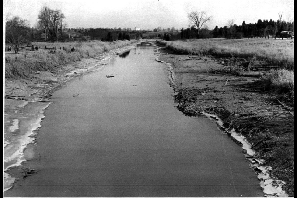
We are left with the question, is the Holland River still passable? As part of an article, I wrote in association with some engineering students a few years ago, I decided to find out. From Newmarket to the old Roger's Reservoir, you primarily will be walking in sludge. Once you get past Old Yonge Street, it becomes quite impassible halfway to the Queensville Sideroad.
The river from Holland Landing north to Cook's Bay seemed quite heavily travelled with power boats from the local marinas along the river.
The location of the development later to be known as Newmarket and its subsequent growth is tied to the fact that Newmarket laid between two ranges of hills, and the undulating topography afforded rapid surface drainage and sanitation into the two branches of the Holland River flowing north to Lake Simcoe.
Years later, Sir William Mulock was to state as his primary reason for supporting the construction of the canal that “the deepening of the east branch of the Holland River to Newmarket and Aurora would make these towns thriving centres, as well as the west branch into King Township and the Black River into Sutton, with such improvements rendering them available as commercial highways.” Sadly, it never happened.
Those who have been around a while, know that the Holland River, often called the ‘crick’ in the old days, can often can periodically demonstrate that it still retains great power. I have written several articles about the flooding of the Holland River.
In 1878 it rained for three days straight and the Gorham Street dam burst. The Holland River swelled in volume and the waterworks dam at Water Street eventually gave way. All bridges were wiped out, 10 between Newmarket and Holland Landing, with much destruction of property.
Another terrible storm occurred in June 1894, also causing heavy damage to the bridges and buildings.And we all remember Hurricane Hazel and how the Holland River became a raging torrent virtually overnight.
Today, the Holland River is but a relic of the past but its place in the establishment and growth of our area has been firmly established.
Sources: All Trails – The Holland River Trail – Website; The Holland River – Wikipedia; The History of Newmarket by Ethel Trewhella; Holland Marsh – Canadian Encyclopedia – Article by A.M. Blair - February 7, 2006; The Yonge Street Story 1793 - 1860 by F. R. Berchem
Newmarket Today - Lessons from Hurricane Hazel will never be forgotten by Richard MacLeod.
Newmarket Today - Area Indigenous peoples ceded their territory in later disputed Toronto Purchase by Richard MacLeod
Newmarket Today - Indigenous trails were 'highways' for Newmarket area's first settlers by Richard MacLeod.
Newmarket Today - When Newmarket was known as a 'nice little village' near Holland Landing by Richard MacLeod
Newmarket Today - Histories of Newmarket and Holland Landing have long been intertwined by Richard MacLeod.
*******************
Newmarket resident Richard MacLeod, the History Hound, has been a local historian for more than 40 years. He writes a weekly feature about our town's history in partnership with Newmarket Today, conducts heritage lectures and walking tours of local interest, and leads local oral history interviews.


