BradfordToday received the following letter from Bert Duclos, former heritage outreach consultant with the Ontario Ministry of Culture, regarding the Bradford Bypass:
It doesn’t look like much, certainly not much different than any other stretch of this or many other rivers. Flat, sparsely wooded, lots of reeds. It’s the winter of 2012 and I’m on the east bank of the Holland River East Branch in East Gwillimbury. The easy, 10 minute, ¾ of a kilometre walk along a path west of the north end of Yonge Street brought me to this pleasant, but not unique, setting. Looking around there is nothing to suggest what once was. But then, what did I expect?
To the Anishinaabe people the river was known as Escoyondy by the Chippewa and as Miciaguean by the Mississauga. Records, historical maps, and the research of many, confirm this as the site of the Lower Landing, one of a variety of place names imposed on it by Euro-Canadians. Other post-contact names included Pine Fort, Landing Place, Fort Gwillimbury, Old Indian Landing, Steamboat Landing, Old Soldier's Landing. We name places that have meaning to us.
But why this place? Geography made it necessary. Around these parts, before the introduction of the horse, people got around by foot or by water. For millennia, Indigenous peoples used this area of the Holland River as a junction to get to and from other places. In dry seasons the Holland River could be a difficult paddle south of here. From the south were trails from Lake Ontario following the Don River and running northwest from the lake along the Rouge River.
Further west, starting at the mouth of the Humber River on Lake Ontario, the Toronto Carrying Place and its trails took foot travellers north to its terminus on the Holland River West Branch where both the river and, its believed, a trail headed east to join up here on the Holland River East Branch.
But for many it was to the north that was the destination. For countless generations the area north of here was home to the Wendat and other Algonquian and Iroquoian-speaking peoples. To these people the Lower Landing area was the natural focus of their travels between points south and home. Going beyond that though, the water route to the upper Great Lakes along Lake Ontario, the Niagara River, Lake Erie and the Detroit River and onward was long, difficult and often through enemy territory.
The much safer and quicker way to reach Lake Huron was via Lake Simcoe and two alternate routes. One by canoe though the narrows into Lake Couchiching and the Severn River and its many rapids to its outlet at Georgian Bay. The other was by canoe to the west end of Kempenfelt Bay then overland nine miles to the Nottawasaga River and its mouth at Nottawasaga Bay.
Indigenous peoples’ knowledge of the value of the Lower Landing was shared with others. It’s believed the first Europeans in the Lower Landing area were Jesuit missionaries Fathers Jean de Brébeuf and Joseph Chaumonot passing through on their return to the Wendat in the spring of 1641. Notable French explorer René-Robert Cavelier, Sieur de La Salle used the route on his August 1681 voyage to the Mississippi.
For over 150 years the fur trade, including coureurs de bois, voyageurs, and the North West Company, used this route to the upper Great Lakes and beyond. The first definitive record of the Lower Landing’s use is of that by Lieutenant Governor John Graves Simcoe and his party on Oct. 11, 1793. They stopped here on their return from Georgian Bay to the new capital of Upper Canada at York while seeking a northern military route. Alexander McDonell, Home District Sheriff, who accompanied Simcoe, wrote in his journal:
“11th - About 9 Oclock left our encampment, embarked and soon got out of the Lake, paddled up the River about three miles, then got in to another River, and about 2 Oclock got to the landing place at the red pine fort.”
On their October 1793 map, Lt. Robert Pilkington, Royal Engineer, and Alexander Aitken, Deputy Surveyor, also of Simcoe’s party, marked this location as Landing Place.
Recognizing the military and supply value of this northern launch point, Simcoe lost no time in ordering the laying out of a cart road, Yonge Street, to here from York. Following a survey by Augustus Jones, Deputy Surveyor General, work cutting out a trail by the Queen’s Rangers began on Jan. 4, 1796 and reached the area of the Lower Landing on Feb. 16. The importance of this to the fledgling colony cannot be understated.
In a Feb. 27, 1796 letter to the British Secretary of State for the Home Department Simcoe wrote: “The Road from York to the Head Waters of Lake Huron has been opened, and by these means, a very excellent Tract of Country is rendered available to future settlers.”
From then on the Lower Landing became of strategic importance to the British colony, its military, its traders, and its settlers. Soon after, a depot of hewn log trade and storage buildings was erected by the North West Company to support its vast fur trade empire. Here Indigenous traders regularly arrived from all over the upper Great Lakes by fur laden canoes to do business. Records speak of no less than 30 large wigwams at times clustered about the banks of the Holland River.
In 1812, David Thompson, the great cartographer and explorer of Canada’s west and participant in the Boundary Commission, stopped at the Lower Landing on his way home to Montreal.
The pivotal role of the Lower Landing in the survival of the young Canadian colony during the War of 1812 is immeasurable. The September 1813 defeat of the British Navy by the Americans in the Battle of Lake Erie was of strategic importance. This heightened the risk of American invasion of Canada as well as their recapture of Fort Michilimackinac, a military and trade outpost strategically located at the straits between Lakes Huron and Michigan, and the resulting British loss of control of the northwest and upper Great Lakes. Lt. Col. Robert McDouall of the Glengarry Light Infantry Fencibles was ordered to strengthen Michilimackinac’s defences.
This being the only practical and safe departure point remaining for a route to Lake Huron, in February 1814, with 10 officers, 220 infantry and artillerymen, and 20 seamen McDouall travelled to York and made his way to the Lower Landing, now an important military and naval depot. Following the trek to the Willow Creek Depot at the end of the portage to the Nottawasaga River, south of present day Edenvale the company built a fleet of 29 bateaux to carry supplies and the reinforcements for Michilimackinac.
Arriving at Michilimackinac on May 18, McDouall set about strengthening its defences. On Aug. 4, American Captain Arthur Sinclair with 600-700 troops and a fleet of four brigs anchored off Michilimackinac and attempted a landing. With McDouall’s preparation, the fort’s defenders successfully defeated the attack on Michilimackinac resulting in Sinclair sending most of his ships back to Lake Erie.
The Royal Ontario Museum’s 1815 painting by Robert Irvine of the Royal Naval Depot Holland Landing shows the many buildings and wharves that stood at the Lower Landing at the time of McDouall’s use.
Throughout the 1800s, the Lower Landing continued to show its importance. On the second of his three Arctic expeditions, in April 1825, renowned explorer Sir John Franklin leading the Mackenzie River Expedition is recorded as arranging passage across Lake Simcoe from the Lower Landing.
During the first decades of the century, the annual distribution of gifts to First Nations from across Upper Canada took place here. At times these events were the occasion of large missionary meetings. One such was attended by the Rev. Peter Jones, (Kahkewāquonāby) Ojibwe chief and Methodist minister, who described the events in his journal of Aug. 13-15, 1828.
From the middle of the 19th century until the building of the railway, the Lower Landing’s docks were a bustling departure point for many steamers carrying mail, cargo, and passengers across Lake Simcoe.
No evidence remains visible of the significance held by this strategic place. Other than the efforts of a few individuals to move forward its identification and commemoration, no formal attempts have been made to conserve the site of the Lower Landing. Its cultural heritage value to the people of Ontario is no less than that of the Willow Creek Depot at the end of the Nine Mile Portage. Yet, the Willow Creek Depot rightfully, successfully, and enviably, enjoys the attention and financial assistance of many authoritative groups.
The site of the Lower Landing is under imminent threat of total loss by the province’s proposed plans for the Bradford Bypass. The route of this highway joining Highway 400 and Highway 404 will put the Lower Landing under the bulldozer and tons of concrete. It’s tough to read a heritage plaque at 120 kilometres per hour.
The province’s official agency tasked with promoting its cultural heritage is the Ontario Heritage Trust. The Trust speaks of the story of Ontario as the story of the interaction of people with each other and with the land for over 10,000 years and of the efforts to conserve and protect these stories of the people, places and events that have shaped our province.
Unlike obvious built heritage examples such as Toronto’s Union Station or Richmond Hills’ Dunlap Observatory, cultural heritage landscapes, like the Lower Landing, don’t attract the public and the media’s attention towards conservation.
Yet, the Legislative Assembly of the Province of Ontario expects it.
Provincial policies under the Planning Act define cultural heritage landscapes as a defined geographical area that may have been modified by human activity and identified as having cultural heritage value or interest by a community, including an Indigenous community. These policies require significant cultural heritage landscapes to be conserved and that development and site alteration shall not be permitted on these lands unless its cultural heritage resources have been conserved.
In addition, there is expectation of the Legislative Assembly that the province and its municipalities conserve these places of cultural importance by use of the tools under the Ontario Heritage Act and criteria defined by its regulations.
The province itself may legally protect a property that yields, or has the potential to yield, information that contributes to an understanding of Ontario’s history, while a municipality may legally protect a property that has historical value or associative value because it has direct associations with a theme, event, belief, person, activity, organization or institution that is significant to a community, or that it yields, or has the potential to yield, information that contributes to an understanding of a community or culture.
Does the Lower Landing meet any of these criteria? Should there be efforts to use these tools to conserve the site of the Lower Landing?
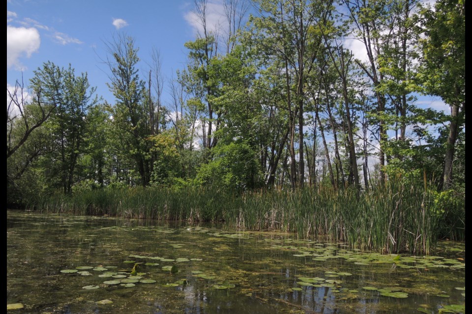
Recently, on the afternoon of a late spring day, I kayaked the placid waters of the Holland River East Branch to the Lower Landing site. Plenty of bulrushes, swallows darting about, bucolic, yet still appearing unexceptional. Looks are deceiving. On the contrary, we know this place that shaped the province is more than exceptional.


.jpeg;w=120;h=80;mode=crop)