WEATHER ALERTS
ENVIRONMENT CANADA
**********************************
Winter storm warning in effect for:
• Innisfil - New Tecumseth - Angus
Major winter storm today into Saturday.
Travel will become hazardous and is not advised.
Hazards:
Flash freeze producing icy and slippery surfaces this morning.
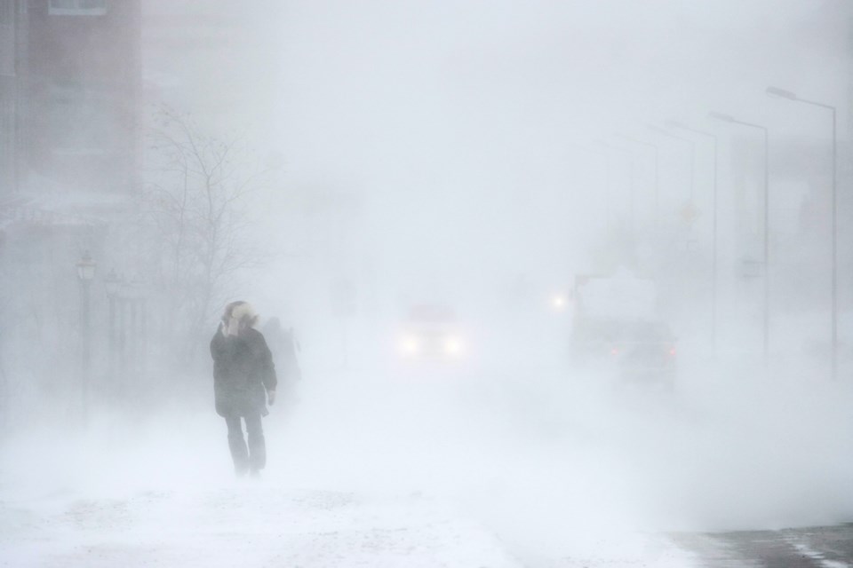
Wind gusts up to 90 km/h resulting in widespread blowing snow which will reduce visibility to near zero at times. Utility outages are possible.
Snowfall amounts of 5 to 15 cm by Saturday morning.
Wind chill values into the minus twenties.
Timing:
Flash freeze possible this morning.
Strong winds and widespread blowing snow developing this morning and continuing into early Saturday morning.
Snow will taper to flurries Saturday morning.
Very cold wind chill values will develop this morning and persist into the weekend.
Discussion: Temperatures are expected to plummet this morning leading to a potential flash freeze. Rapidly falling temperatures will be accompanied by snow and very strong winds which will result in widespread blowing snow. Remember, it does not take much accumulation in combination with very strong winds for whiteout conditions to develop.
Consider postponing non-essential travel until conditions improve. Visibility will be suddenly reduced to near zero at times in heavy snow and blowing snow. If visibility is reduced while driving, slow down, watch for tail lights ahead and be prepared to stop. Public Safety Canada encourages everyone to make an emergency plan and get an emergency kit with drinking water, food, medicine, a first-aid kit and a flashlight. For information on emergency plans and kits go to http://www.getprepared.gc.ca.
Please continue to monitor alerts and forecasts issued by Environment Canada. To report severe weather, send an email to [email protected] or tweet reports using #ONStorm.
**********************************
Winter storm warning in effect for:
• Barrie - Collingwood - Hillsdale
Major winter storm today into Saturday.
Travel will become dangerous and is not advised.
Hazards:
Snowfall amounts of 5 to 10 cm by early this evening. Lake effect snow off Georgian Bay beginning this evening. Local snowfall amounts of 25 to 50 cm are possible by Saturday night. The most significant lake effect snow appears to remain north of Barrie through Saturday afternoon.
Wind gusts up to 90 km/h resulting in significantly reduced visibility and blizzard-like conditions. Utility outages are possible.
Wind chill values near minus 20.
Flash freeze producing icy and slippery surfaces.
Timing:
Strong winds and widespread blowing snow developing this afternoon and continuing into Saturday.
Snow begins this morning with snow squalls developing this evening and continuing through Saturday.
Very cold wind chill values will develop this afternoon and persist into the weekend.
Flash freeze possible this morning.
Discussion:
Temperatures are expected to plummet this morning leading to a potential flash freeze. Rapidly falling temperatures will be accompanied by extensive blowing snow and very strong winds, especially as lake effect snow develops off Georgian Bay. Given the localized nature of lake effect snow, accumulations will vary depending on location. Remember, it does not take much accumulation in combination with very strong winds for whiteout conditions to develop.
Consider postponing non-essential travel until conditions improve. Visibility will be suddenly reduced to near zero at times in heavy snow and blowing snow. If visibility is reduced while driving, slow down, watch for tail lights ahead and be prepared to stop. Public Safety Canada encourages everyone to make an emergency plan and get an emergency kit with drinking water, food, medicine, a first-aid kit and a flashlight. For information on emergency plans and kits go to http://www.getprepared.gc.ca.
Please continue to monitor alerts and forecasts issued by Environment Canada. To report severe weather, send an email to [email protected] or tweet reports using #ONStorm.
**********************************


